Tracing round buildings - iD editor
Updated 2019-06-24
The Essentials

Points to note;
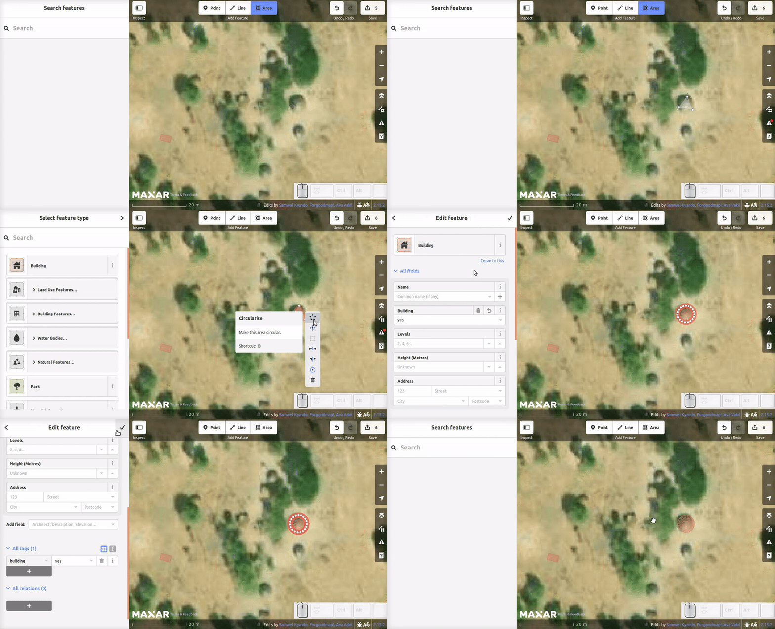
- Place your points where the walls will reach the ground - 3 points is the minimum. Double click on the last point to finish tracing an area. Use the tool to make it round - shortcut o in English.
- Make sure you tag!
- Size matters - population estimates are based on the cumulative building area in a given area,
- Zoom in enough to see the details - a zoom scale of 20 metres or less is usually about right.
- Looking for buildings - scan with your scale somewhere between 50 metres and 80 metres. Watch out for shadows and straight lines (round buildings are harder to find!)
- Buildings and roads, rivers, landuse=residential boundaries or other features should not overlap.
- If you make a mistake, use the Undo button
 to undo your last change(s)
- We’re all improving the map. If the previous mapper has left the buildings a funny shape or wrong in some way, correct it and consider sending them a polite message.
Building - converting square to round

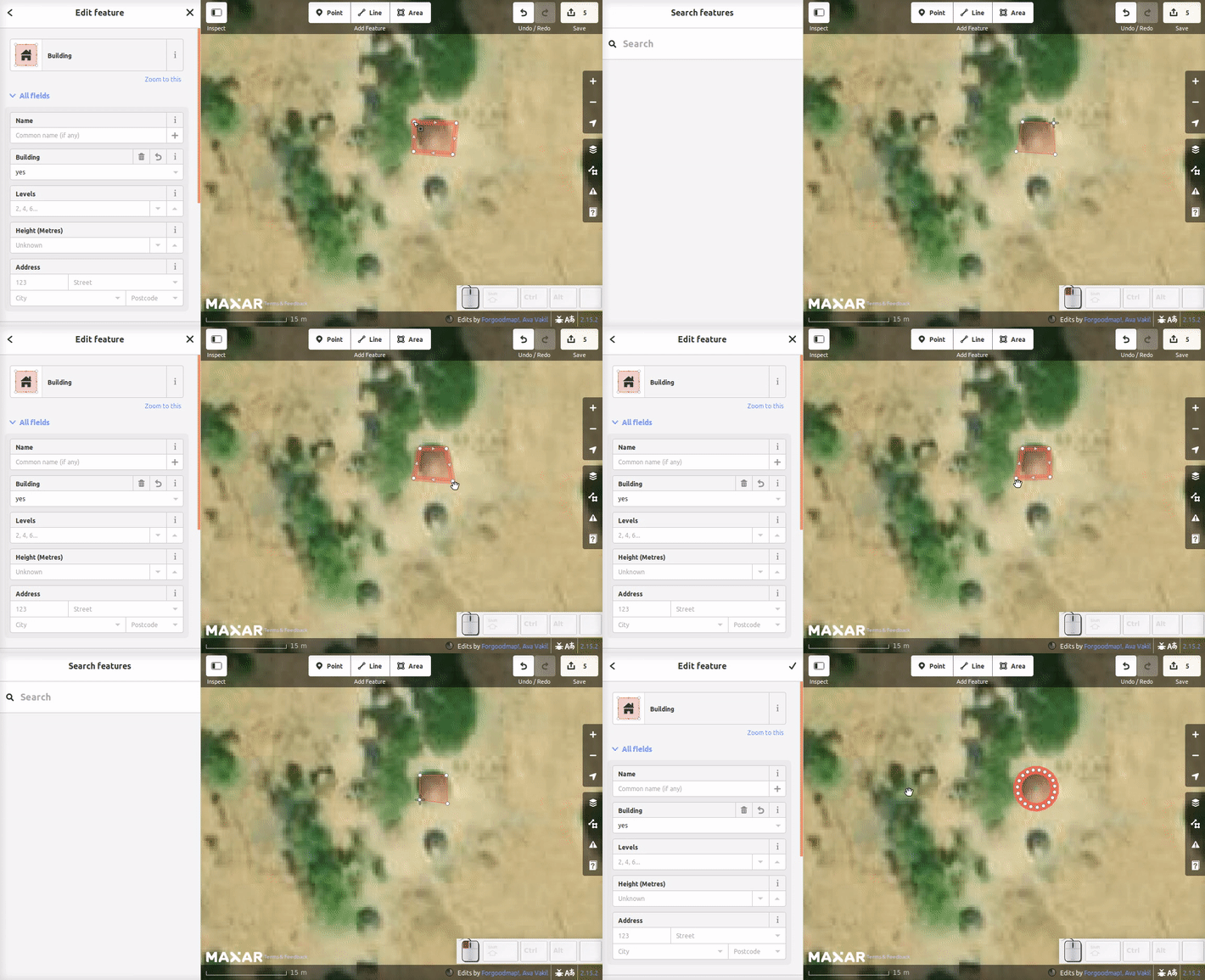
If a building has been traced as rectangular, but you can see it should be round it is easy to convert to a round building;
- move each of the corners so they are now on the perimeter of the round building,
- right click and use the circularise tool, or shortcut o - may be a different character in other languages.
Identification
Round buildings are often found within a compound, and the buildings may be in clusters, or in isolation. It can be difficult to establish if you are looking at a round building or a bush or rock. Buildings are usually found near some means of access such as a path or track, although this can be difficult to see on very hard ground. The vegetation may be worn down by the passage of feet. In some parts of the world the buildings may be on the only dry land, and the access is by boat on a river or lake. There is normally a water source visible within 2 or 3 kilometres of any habitation, but in many parts of the world you do not see the water, but you do see more vegetation to indicate it must be there.
In many places in the world it is easier to build a new village a short distance from the old one, leaving the old buildings to rot away and fall down - sometimes they are destroyed by fire. Look for shadows to help you decide what you are looking at. If all that is left is a round mark on the ground, it will have no shadow. If in doubt add it as a building.

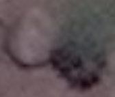
This image shows both a bush and a round building. Shadows can help you to identify if you are looking at a round building, or a bush. In hot climates it is common to find buildings close to trees or bushes which will provide shelter and shade. The instructions to this particular task include a link to a diary entry by someone who has taken photographs of the buildings in the area, and gives a description. Please take the time to read this information. Round buildings can have slightly different construction materials in other areas of the world, and their roofs will appear different - the project instructions will often include guides to help you understand what you are seeing.
Do your best - even the experts will disagree sometimes, and sometimes you just have to go there to see exactly what is really there. If in doubt add it as a building.
As we are tagging buildings we have never visited and are not familiar with, the safest and recommended tagging scheme is building=yes which you can see on a correctly tagged building if scroll to the bottom of the tagging pane and click on All tags.
See also
Ivan Gayton’s diary entry for Hadjer Lamis, Chad - comments from others indicate the description fits other parts of the world as well


 to undo your last change(s)


 回到頁面頂端