- Other guides
- Beginner's guide
- JOSM - Detailed Editing
- Coordination
- Mapping with a SmartPhone, GPS or Paper
- OSM Data
- HOT Tips - Getting started for new mappers - iD editor
- Starting with a Tasking Manager - iD editor
- Aerial imagery & Alignment - iD editor
- Issues - iD editor
- Tracing rectangular buildings - iD editor
- Tracing round buildings - iD editor
- Saving - changeset comment & Task Manager finishing a square - iD editor
- Tagging - iD editor
- Copying, Pasting & Rotating - iD editor
- Other Resources
|
|
Aerial imagery & Alignment - iD editor
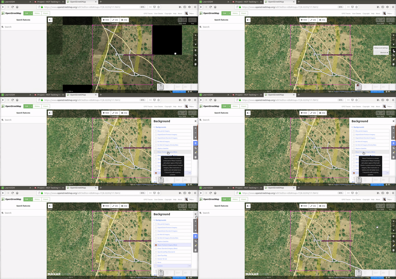
Changing the background aerial imagery
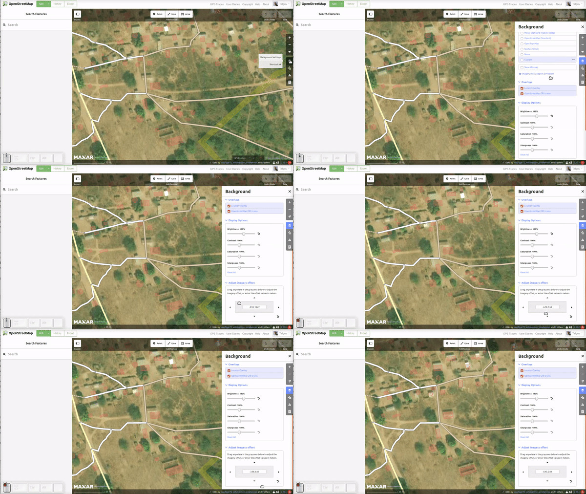
To change the background imagery select the background icon in the menu, shown in the above image, and select the required imagery from the list. If the imagery is not listed, you can add it by pasting the provided link into the custom box. Brightness, contrast, saturation and sharpness may also be adjusted, which may help in identifying features. Aligning the background aerial imagery
There are occasions when you may realise that the imagery you have loaded is not aligned;
If you are working on a really large area, you may find that the imagery requires realignment part way during your work. See alsoPlease see the main iD article on this site.
Was this chapter helpful?
Let us know and help us improve the guides!
|


 Return to top of page